Water Borehole in Comporta and Melides: Aquifer, Licence and Cost
We drill water boreholes in Comporta (Alcácer do Sal), Melides and Carvalhal (Grândola), between the Sado estuary and the Grândola coast. We assess your plot, tell you about the local restrictions before we drill, and handle the licence with APA/ARH. Free quote within 24–48 h, in English.
Updated 22 October 2026 · Sources at the end of the page
What is different about this coast
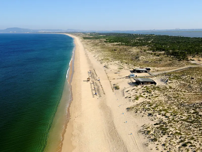
This is a landscape of lagoon, dune, estuary and rice fields, in two municipalities: Alcácer do Sal (Comporta) and Grândola (Melides and Carvalhal). Rules and protected areas change from plot to plot, so we check yours before we propose a borehole. The Natura 2000 site Comporta/Galé (PTCON0034) is a Special Area of Conservation under Decree-Law 55/2026, which makes some acts on rural land subject to an opinion from ICNF, the nature conservation institute. We check on the map whether your plot is inside it.
Comporta
The Comporta parish has 1,094 residents (INE, 2021 Census) and about 155 km² between the Atlantic coast and the Sado estuary. The environmental impact study for the ADT3 area of Herdade da Comporta (CCDR Alentejo) describes two aquifer subsystems: a shallow one with weakly mineralised, slightly acidic (pH 6.3) sodium-chloride water, and a deeper semi-confined one with slightly alkaline (pH 8.0) calcium-bicarbonate water, around 180 mg/l mineralisation. The study counts 32 research and abstraction boreholes on the estate, five of them for public supply, and notes that some abstractions are still not inventoried. It also plans to spread abstractions horizontally and vertically to avoid excessive drawdown and saltwater-wedge advance. These figures are for Herdade da Comporta, not for every plot in the parish.
A licence in Comporta is not automatic. According to the Setúbal District Farmers' Association, the APA refused two boreholes for agricultural use at Herdade da Comporta in October 2023 (Semmais, April 2024). We do not know the full decision. We assess your plot first and we cannot guarantee that APA approves a request.
Melides
Melides has 1,459 residents and 1,831 dwellings, of which 65.0% are vacant or second homes (national average: 30.8%; INE, 2021 Census). The Melides lagoon sits inside the Comporta/Galé site. Studies of the lagoon (GROUNDSCENE project) indicate that it receives groundwater from the Sines aquifer system and that over-abstraction may have significant impacts on it and on the associated ecosystems. So we size the borehole for your real use, not for the maximum.
Carvalhal
Carvalhal (in Grândola municipality, not the other places of the same name) has 1,518 residents (INE, 2021 Census). It shares rice growing with Comporta. In public irrigation areas, the ARH Alentejo notice of 8 May 2026 keeps new groundwater titles and agricultural irrigation from boreholes suspended; see our 2026 rules page (in Portuguese). A large-flow irrigation borehole is a different project with a different quote.
Licence and water quality
Every borehole goes through the APA process on the SILiAmb platform: prior notification with a pump up to 5 hp, a licence above that. Both municipalities are in the Sado and Mira river basin district (RH6), managed by ARH Alentejo. We handle the process for you. Near the coast, the risk of brackish water has to be assessed: we ask for a conductivity and chloride test. Drinking water only after a test by an accredited laboratory.
Comporta and Melides in the Alentejo context
Which aquifer is under your plot
Comporta sits on the T3 Tejo-Sado (left bank) system. In the ADT3 water note, wells in the shallow level yield about 20 l/s on average and wells in the semi-confined level about 50 l/s. Melides is different: its lagoon is fed by the Sines aquifer system, where the boreholes inventoried in 1998 were 48 to 290 m deep. Further inland lies the Alvalade basin (system T6, about 702 km², with free, confined and semi-confined levels and recharge of around 40 hm³ a year). The exact pin of your plot tells us which one applies.
ARH Alentejo rules on this coast
The licensing authority is ARH Alentejo, the same as in Évora or Beja, and the basic rule is the same everywhere: prior notification up to 5 hp, a licence above. The coast adds its own layers: the Espichel–Odeceixe coastal programme, the Comporta/Galé Special Area of Conservation and the Sado estuary. The notice of 8 May 2026, valid across the Alentejo, keeps new groundwater titles and borehole irrigation suspended inside public irrigation schemes, and we check the DGADR irrigation register before we propose anything.
Compared with inland Alentejo
Inland, around Évora and Beja, water is mostly in hard crystalline rock. The ERHSA study by the University of Évora puts typical yields there at about 1 l/s, and in the Beja gabbros the productive levels lie 12 to 20 m deep on average. On this coast quantity is rarely the problem; salinity, the lagoon and the protected areas are.
Cost in the Alentejo context
Our indicative price is €20–60 per metre drilled (excl. VAT), depending on the soil, whether there is rock and the depth to water. On sand near the estuary or the lagoon, the depth, the casing and the water tests change those lines. See borehole cost in the Alentejo.
In Portuguese: furo de água na Comporta and furo de água em Melides.
What it costs
Our indicative prices are €20–60 per metre drilled (excl. VAT), depending on the soil, whether there is rock and the depth to water, and a complete domestic borehole usually costs €4,000–8,000, without the pump; a large-flow agricultural borehole is a different project. Only a quote for your plot gives the final price. See borehole cost in the Alentejo.
How to ask for a quote
Portuguese version: Furos de água na costa alentejana · pages for Melides, Comporta and Carvalhal.
Frequently asked questions
Do I need a licence for a borehole in Comporta or Melides?
Yes, always. Every groundwater abstraction goes through the APA process: prior notification with a pump up to 5 hp, a licence above 5 hp. We handle the process, and we first check whether your plot is in the Comporta/Galé Natura 2000 site or another restricted area.
How much does a borehole cost in Comporta?
In Comporta our indicative prices are the same: €20–60 per metre drilled (excl. VAT), depending on the soil, whether there is rock and the depth to water, and usually €4,000–8,000 for a complete domestic borehole, without the pump. Agricultural boreholes cost considerably more. The real figure depends on depth and rock.
Is the water near the coast brackish?
It can be. Near the coast and the estuary the risk of brackish water must be assessed with conductivity and chlorides. For drinking, only after a test by an accredited laboratory.
Can a borehole in Melides affect the lagoon?
Studies of the Melides lagoon indicate that it receives groundwater from the Sines aquifer system and that over-abstraction may affect it. We cannot say what a specific borehole would do without seeing the plot, so we size it for your real use and check the restrictions first.
Do you speak English?
Yes. We prepare the quote, explain the licence and talk to you in English. Use the form below or call or WhatsApp +351 923 297 575.
How does a borehole here compare with inland Alentejo?
Inland, around Évora and Beja, water is mostly in hard rock, with typical yields of about 1 l/s (ERHSA). In Comporta, wells in the sandy aquifer yield far more (about 20 to 50 l/s on average in the ADT3 study), but salinity and protected areas set the limits. The licence is the same: ARH Alentejo.
Sources
- INE, 2021 Census — population by parish: Comporta (via Todo Portugal; area: DGT, CAOP). todoportugal.pt
- Alcácer do Sal Municipality — Comporta parish (population, area, localities, economic activities). cm-alcacerdosal.pt
- INE, 2021 Census — population by parish: Carvalhal and Melides, Grândola municipality (via Todo Portugal; area: DGT, CAOP). todoportugal.pt
- INE, 2021 Census — Melides: dwellings and share of vacant or second-home dwellings (via Arredores). arredores.pt
- CCDR Alentejo — Environmental Impact Study, ADT3 golf course, Herdade da Comporta, annex "Groundwater Resources" (PDF, in Portuguese). ccdr-a.gov.pt
- Semmais, "Rice plantings at risk for lack of flooded land" (2 Apr 2024), Setúbal District Farmers' Association (in Portuguese). semmais.pt
- GROUNDSCENE project — coastal lagoons (Melides and Santo André) as groundwater-dependent ecosystems. doi.org
- Diário da República — Decree-Law 55/2026 of 16 February (Comporta/Galé Special Area of Conservation, PTCON0034; in Portuguese). diariodarepublica.pt
- Lavaredas & Oliveira da Silva, hydrogeology of the Sines aquifer system, APRH 1998 (PDF, in Portuguese). aprh.pt
- Almeida et al., "Sistemas Aquíferos de Portugal Continental" (INAG/SNIRH) — T6 Alvalade basin factsheet: area, aquifer type, recharge (in Portuguese). apambiente.pt (SNIRH)
- Chambel & Duque, ERHSA groundwater study of the Alentejo, University of Évora, APRH 1998 (PDF, in Portuguese). aprh.pt
- Paralta, hydrogeology of the Beja gabbro aquifer (Ribeira da Chaminé), APRH 1998 (PDF, in Portuguese). aprh.pt
- APA-ARH Alentejo, Notice 000073-ARHALT of 8 May 2026 — groundwater titles and irrigation in public schemes (PDF, in Portuguese). apambiente.pt
- DGADR — SIR, irrigation information system (public irrigation schemes). sir.dgadr.gov.pt
Sources consulted up to 22 October 2026. Indicative values; always confirm with the written quote and with ARH.
Get your free quote
Response within 24–48 h · No obligation. Leave your details, describe the property and we will get back to you.